
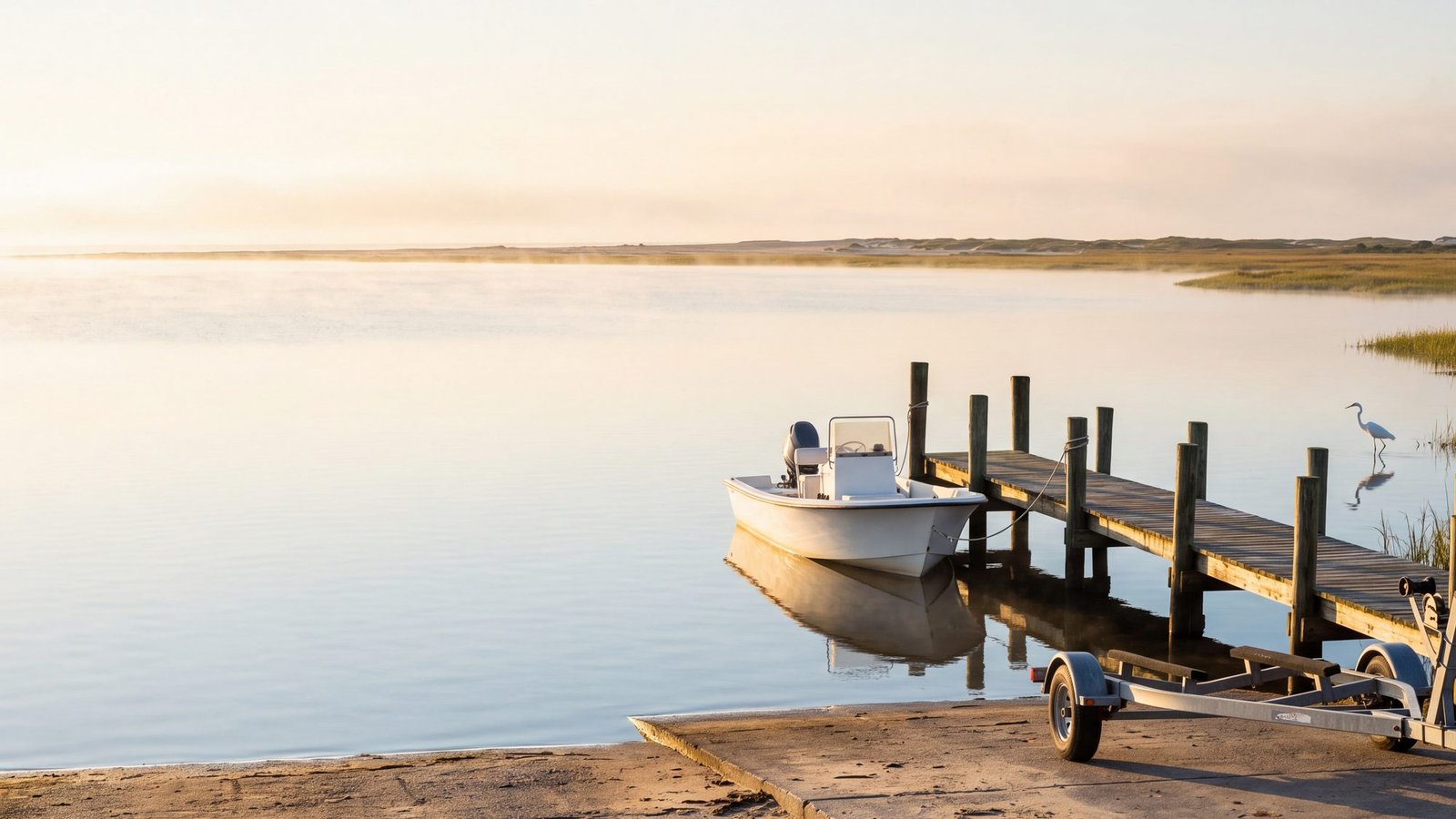
Behind the beach is the other Outer Banks: more than 2,500 square miles of sound, most of it a few feet deep, warm by June, and empty on a weekday. Getting a boat onto it is free almost everywhere — the state, the counties, the towns, the Park Service and the wildlife refuges all run ramps — but the ramps are scattered from Knotts Island to Ocracoke and nobody keeps them on one map. This is that map.
Every pin is a public launch, checked against whoever runs it. Trailer ramps are green. Carry-in kayak and small-boat launches, where you walk the boat down to the water, are blue. The one orange pin is on a Park Service soundside vehicle route, which takes an ORV permit to reach; the others like it are listed under Pamlico Sound. Marinas that launch for a fee are mentioned where they are the only option, in Frisco and Hatteras village, but they are not on the map.
Every public launch, on one map
Tap a pin for lanes, parking and rules. Pins sit on each agency’s own coordinates or on the posted street address; a couple are marked approximate in the popup. Map data © OpenStreetMap contributors.
Currituck Sound and the northern beaches
The shallowest water on the coast. The Army Corps puts Currituck Sound’s average depth at 5 feet, the north end is choked with grass in summer, and the ramp at Corolla is a one-lane affair meant for kayaks and skiffs. The serious trailer ramps for this sound are on the mainland side of the bridge, and the three state ramps there have lights, docks and room for a truck and trailer.
| Launch | Runs it | What you get |
|---|---|---|
| Carova Beach Park & Boat Ramp Carova | Currituck County | 2011 Ocean Pearl Rd. 8 a.m. to sunset. Reached only by driving the 4x4 beach; restrooms and grills. |
| Historic Corolla Park Corolla | Currituck County | Single lane and a courtesy dock at the end of the Whalehead lot. Free parking. Closed dusk to dawn. Very shallow water: kayaks, canoes and skiffs. |
| Duck Town Park kayak launch Duck | Town of Duck | Paddle craft only, free, off the soundside boardwalk. 32 spaces. |
| Sound Park Point Harbor | Currituck County | 8955 Caratoke Hwy, just before the Wright Memorial Bridge. Two launch lanes, restrooms, pavilions. 8 a.m. to sunset. |
| Poplar Branch Poplar Branch | NC Wildlife | Two lanes, 16 trailer spaces, lit, paddle access. Currituck Sound from the mainland side. |
| Coinjock (Waterlily Rd) Coinjock | NC Wildlife | Two lanes, 20 trailer spaces, restroom, lit. On the Intracoastal Waterway. |
| Brumley Rd, Knotts Island Knotts Island | Currituck County | One lane, 26 trailer spaces. The north end of Currituck Sound. |
Currituck County parks open at 8 a.m. and close at sunset; the Corolla ramp is posted closed from dusk to dawn year-round.
Kitty Hawk Bay and Albemarle Sound
Two trailer ramps side by side on the bay, one county and one state, and a town park that is the best beginner paddle on the beach. Kitty Hawk Bay is a good place to learn a sound: sheltered from the northeast by the island, open to the southwest, and never far from a shoreline.
| Launch | Runs it | What you get |
|---|---|---|
| Kitty Hawk Boat Ramp Kitty Hawk | Dare County | 4190 Bob Perry Rd. A canal out to Kitty Hawk Bay, parking for about 30, picnic area. No overnight dockage. |
| Avalon Beach (Bay Dr) Kill Devil Hills | NC Wildlife | 2028 Bay Dr. Two lanes, 22 trailer spaces, docks, paddle access. No restroom. |
| Sandy Run Park Kitty Hawk | Town of Kitty Hawk | 4343 The Woods Rd. Carry-in kayak access from the gazebos into the creek and marsh; turtles, herons, a boardwalk loop. |
Roanoke Sound, Croatan Sound and the mainland ramps
Where most of the trailer traffic goes. Washington Baum Bridge is the biggest public ramp on the Outer Banks — five lanes, restrooms, a fishing walkway and 55 trailer spaces — and it is the one to use for Roanoke Sound, Oregon Inlet by water, or the back side of Bodie Island. Across the island, Manns Harbor has three lanes and 78 spaces on Croatan Sound, and the small state ramps at Mashoes and Stumpy Point get you into East Lake, the Alligator River and the mainland side of Pamlico Sound with nobody around. Nags Head’s sound accesses are for paddle craft; the town lists six, and the two on the causeway have real parking.
| Launch | Runs it | What you get |
|---|---|---|
| Washington Baum Bridge Nags Head–Manteo causeway | NC Wildlife | Under the bridge, across from Pirate’s Cove. Five lanes, 55 trailer spaces, restroom, lights, fishing walkway. The big one. |
| Edward’s Landing Manteo | Town of Manteo | Queen Elizabeth St downtown, next to the bridge to Festival Park. Free; parking is tight in season. |
| Bowsertown Rd Manteo | NC Wildlife | West end of Bowsertown Rd past the town water plant. Two lanes, 26 trailer spaces, restroom. Croatan Sound. |
| Wanchese Wanchese | Dare County | 4695 Mill Landing Rd. Built for loading and unloading trailered boats; limited parking, no overnight dockage. Pin is on the address. |
| Manns Harbor Manns Harbor | NC Wildlife | 5227 US 64, beside the old bridge. Three lanes, 78 trailer spaces, lit, paddle access. Croatan Sound. |
| Mashoes Manns Harbor | NC Wildlife | 2081 Mashoes Rd. One lane, 16 trailer spaces. East Lake, and from there the Alligator River and Albemarle Sound. |
| Stumpy Point Stumpy Point | NC Wildlife | 321 Bayview Dr. One lane, 5 trailer spaces, lit. Pamlico Sound from the mainland side. |
| Nags Head Estuarine Site Nags Head causeway | Town of Nags Head | Kayak launch, 19 spaces, gazebo, portable toilet. |
| Harvey Sound Access Nags Head, MP 16 | Town of Nags Head | 6912 S Croatan Hwy. Paddle craft only. |
| Jockey’s Ridge soundside Nags Head | State park | Off West Soundside Rd. Paddle craft only; the sound side of the dunes. Pin is approximate. |
Nags Head’s other sound accesses — Little Bridge on the causeway, West Danube St in Old Nags Head Cove, and Forrest St — are paddle-only and Forrest St has no parking at all. Dare County posts “no overnight dockage” at Kitty Hawk, Wanchese and Rodanthe.
Pamlico Sound: Oregon Inlet to Hatteras Inlet
Hatteras Island has one big free ramp at each end and a county ramp in the middle. Oregon Inlet is the Park Service’s five-lane launch behind the Fishing Center: no fee, restrooms, water, and the closest public ramp to the ocean north of Ocracoke. It is also a working inlet with a charter fleet, a Coast Guard station and a channel that shoals, so it earns the Park Service’s warning about currents and wakes. Rodanthe, opened by Dare County in October 2021, has two lanes and a long floating dock and goes out through a marked channel. In between, the refuge ramp at New Inlet is for shallow-draft boats and the Park Service’s soundside day-use areas at Salvo, Haulover and Sandy Bay are sand launches you carry a kayak down to — the same beaches the kiteboarders use, which tells you about the wind.
| Launch | Runs it | What you get |
|---|---|---|
| Oregon Inlet Boat Launch Bodie Island | National Park Service | Behind the Fishing Center. Five ramps, five finger piers, an accessible floating dock, 77 trailer spaces plus 2 accessible, restrooms, water. Free. A working inlet: currents, wakes, shoals. |
| Oregon Inlet kayak launch Bodie Island | National Park Service | Its own lot and a maintained path to the sound, south of the ramps. |
| Pea Island (New Inlet) Pea Island refuge | US Fish & Wildlife | About 3 miles south of the refuge visitor center. Shallow-draft ramp. No kiteboards, windsurfers or jet skis in the refuge. NCDOT closes it now and then for road work; look for the sign. |
| Rodanthe Rodanthe | Dare County | 23170 Myrna Peters Rd. Two lanes with a 60-foot floating dock between them, 14 to 16 trailer spaces, lit. Out through Blackmar Gut to the sound. No overnight dockage. |
| Salvo Day Use Area Salvo | National Park Service | Sand launch for kayaks and small boats, trailer spaces, seasonal restrooms and an outdoor shower. Kite and windsurf beach. |
| Little Kinnakeet sound access north of Avon | National Park Service | Soundside ORV route: an ORV permit to drive to it. Kayak and small-boat launch, no facilities. |
| Avon Harbor Avon | Public | Harbor Rd, across from the Avon Worship Center. Small; parking for about 20. Pin is on the road. |
| Haulover / Canadian Hole between Avon and Buxton | National Park Service | Carry-in launch, bathhouse with showers and restrooms. The kiteboarding beach; one to two feet of water near shore. |
| Sandy Bay Frisco–Hatteras | National Park Service | 26 spaces, a boardwalk over the dune, sound on one side and ocean on the other. No restrooms. Windy. |
Frisco and Hatteras village have no public trailer ramp: the marinas launch for a fee, and Hatteras Harbor, Teach’s Lair and Oden’s Dock are all in the village. Call before you tow. The Park Service’s other soundside vehicle accesses (ramps 46 to 60 between Salvo and Buxton) all have a kayak launch and all take an ORV permit.
Ocracoke
One ramp, and it is free: the Park Service’s Ocracoke Boat Launch at the very end of NC 12, across from the visitor center and beside the Cedar Island and Swan Quarter ferry docks. Two ramps with docks and enough trailer parking. If you are arriving by boat instead, the Park Service’s Silver Lake docks next door are first come, first served and charge by length — $33 a night for a boat up to 24 feet, rising to $88 at 57 feet and over — paid through the Recreation.gov app, which you want downloaded before you lose signal on the ferry. The Anchorage Marina on the harbor also launches trailered boats for a small fee.
| Launch | Runs it | What you get |
|---|---|---|
| Ocracoke Boat Launch Ocracoke village | National Park Service | End of NC 12 by the Cedar Island and Swan Quarter ferry docks. Two ramps with docks, trailer parking, picnic tables. Free to launch. |
The mainland paddle: Alligator River
Twenty minutes west of Manteo, the Buffalo City launch in Alligator River National Wildlife Refuge is the best flat-water paddle in the region and the only one with alligators in it. Four color-coded trails leave from the end of the road — a 1.5-mile loop, 2 miles to Sawyer Lake, 4 miles down Milltail Creek to the river, and 5.5 miles up the creek to a second launch on Milltail Road — marked with white posts. Parking fills on summer mornings. Our bear page covers the refuge’s other residents and the drive in.
Read the sound before you launch
The sounds have almost no moon tide. What moves the water is wind, and it moves a lot of it: a hard southwest wind pushes Pamlico Sound away from Hatteras Island and stacks it on the mainland, and when the wind swings around behind a front it comes back. The Weather Service’s write-up of one January storm says it plainly — south to southwest winds “pushed the water away from Hatteras Island,” then the shift to west and northwest caused “sharp water level rises in Hatteras Village.” For a ramp that means the same launch can be a foot deeper or a foot shallower than yesterday. Check the wind first, then the ramp. Our shallow-water page has the depths sound by sound; the sister site has a plain-words explainer on wind and the sound-side tide.
Wind over the sounds, now and the next few days
What the instruments say right now
NOAA has two stations on the sound side, and one of them is at the Oregon Inlet ramp. There is nothing official on Currituck or Albemarle Sound; for the north end use the Duck pier for wind and the map above for the rest.
Oregon Inlet Marina — the Oregon Inlet ramp itself
Coast Guard station, Hatteras village, sound side
Duck pier — ocean side, but the nearest official wind for the north end
The rules that catch people
- Kayaks, canoes and paddleboards do not need to be registered in North Carolina. Anything with a motor does, jet skis included, and so does a sailboat longer than 14 feet at the waterline.
- Born on or after January 1, 1988? You need a boating safety course certificate to run a motor of 10 horsepower or more. That includes a rented skiff.
- Children under 13 must wear a life jacket whenever the boat is moving. On a jet ski everyone wears one, driver and passengers.
- Nothing overnight at the Dare County ramps (Kitty Hawk, Wanchese, Rodanthe), and the Currituck County parks lock at sunset. Plan the return leg for daylight.
- Pea Island bans kiteboards, windsurfers and jet skis across the whole refuge; the launch there is for boats and paddle craft.
- The Park Service’s soundside vehicle accesses take an ORV permit to drive to, the same one as the ocean beach. The 4x4 map covers the permit and the ramps.
- Oregon Inlet is a working inlet. Charter boats leave in the dark, the Coast Guard station is next door, and the bar moves. If you have never run it, go out behind someone who has, on a slack tide, in daylight.
The chart on your phone
A paper chart of a sound is mostly white space with a number in it. The phone apps are better here because they show the marked channels and, in two of them, the Army Corps surveys of the inlets. All three of the ones we compare let you try them free — Navionics for a week, Aqua Map for two — and the comparison has the trial links and the honest verdict.
Asked and answered
Where can I launch a boat for free on the Outer Banks?
Almost everywhere. The state Wildlife Commission ramps (Washington Baum Bridge, Bowsertown Rd, Manns Harbor, Mashoes, Stumpy Point, Avalon Beach in Kill Devil Hills, Poplar Branch, Coinjock), the Dare County ramps at Kitty Hawk, Wanchese and Rodanthe, the Currituck County parks, the town ramp in Manteo, and the National Park Service ramps at Oregon Inlet and Ocracoke are all free. The only places you pay to launch are the private marinas in Frisco and Hatteras village.
What is the biggest boat ramp on the Outer Banks?
Washington Baum Bridge, the state ramp under the causeway bridge between Nags Head and Manteo: five lanes, 55 trailer spaces, restrooms, lights and a fishing walkway. Manns Harbor has three lanes and the most parking, 78 trailer spaces. Oregon Inlet has five ramps and 77 trailer spaces and is the one for the ocean.
Is there a public boat ramp in Hatteras village or Frisco?
No. The nearest public ramps are Avon Harbor, a small one on Harbor Rd, and the Park Service ramp at Oregon Inlet to the north. In Frisco and Hatteras village the marinas launch trailered boats for a fee. On Ocracoke the Park Service ramp at the end of NC 12 is free.
Where can I launch a kayak on the Outer Banks?
Duck Town Park, Sandy Run Park in Kitty Hawk, the Nags Head sound accesses on the causeway, the kayak launch at Oregon Inlet, the Park Service day-use areas at Salvo, Haulover and Sandy Bay on Hatteras Island, Historic Corolla Park, and every trailer ramp on this page. For a real paddle, Buffalo City in Alligator River refuge has four marked trails.
Do I need to register a kayak in North Carolina?
No. Rowboats, canoes, kayaks and rafts moved only by paddle, oar or current are exempt. Any vessel with a motor must be registered, and so must a sailboat longer than 14 feet at the waterline.
Why is the water so low at the ramp?
Wind. The sounds have almost no moon tide, so the water level is set by which way the wind has been blowing. A strong southwest wind pushes Pamlico Sound away from Hatteras Island and lowers the ramps there; a northeast or northwest wind pushes it back. Check the wind forecast before you tow, especially with a deeper boat.
Checked against the sources
The state ramps (lanes, trailer spaces, docks, restrooms, lighting, coordinates) are from the North Carolina Wildlife Resources Commission’s boating access area data, read directly from the Commission’s map service in September 2026. Dare County’s Kitty Hawk, Rodanthe and Wanchese ramps are from the county’s boating access page; Currituck County’s parks and hours from the county parks page; Manteo’s from the town’s boat ramps page; Nags Head’s sound accesses from the town’s list.
The Park Service sites (Oregon Inlet ramps and kayak launch, Salvo, Haulover, Sandy Bay, Little Kinnakeet, the Ocracoke launch, the Silver Lake docking fees) are from the National Park Service’s own place pages and fee page for Cape Hatteras National Seashore, with coordinates from the Park Service’s places database. Pea Island and Alligator River are from the U.S. Fish & Wildlife Service refuge pages. Historic Corolla Park details are from the Currituck tourism office and the park listing.
The rules — registration exemptions, the 1988 boater-education cutoff, life jackets for children under 13 and on jet skis — are from the Wildlife Commission’s boating law pages. The wind-tide quotes are from the National Weather Service Newport/Morehead City office’s summary of the January 3–4, 2022 storm. Sound depths are the Army Corps and Geological Survey figures used on our shallow-water page.
What we sell: nothing on this page. The chart-app links go to our own comparison; the map pins are ours, placed on the agencies’ coordinates or the posted address. Last checked: September 2026.