
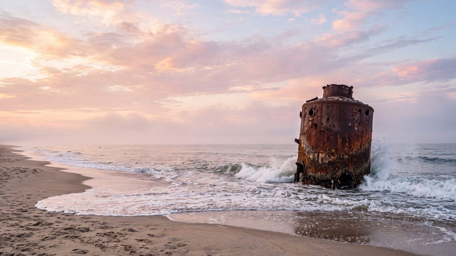
The Outer Banks shipwrecks scattered along this shore are what earned it the nickname the Graveyard of the Atlantic. More than 2,000 ships have wrecked here (some counts run 3,000), driven onto Diamond Shoals by the collision of the cold Labrador Current and the warm Gulf Stream just offshore. What almost nobody tells you: you don’t need a dive boat to see it. Eight wrecks are visible from the beach — some every single day, some when the sand and tide cooperate.
One wreck that is not out here: Blackbeard’s Queen Anne’s Revenge, which grounded in Beaufort Inlet in 1718 and was found off Fort Macon in 1996. The man himself died at Ocracoke that November — the full account is on our Blackbeard page, and Blackbeard’s Gold is the hunt for what happened to his treasure, walked through the village on your phone.
The Ocracoke side now has a dedicated site — what was recovered from his flagship, and why the gold has never turned up — including every ferry route to the island.
The most famous wreck on this coast is not on this list, because you cannot see it from the beach: Blackbeard’s flagship, the Queen Anne’s Revenge, lies in 28 feet of water off Atlantic Beach. His own end came in the shallows off Ocracoke — where Blackbeard died, and whether the treasure is real.
Every viewing spot below is pinned with its beach access. One theme you’ll notice: low tide and calm water are the shipwreck-watcher’s best friends, and a storm that rearranges the beach sometimes uncovers a hull nobody’s seen in years.
Save this map to your phone for offline use
The three you can (almost) count on
The Oriental is the sure thing — a Union transport that grounded off Pea Island on May 16, 1862, whose boiler still breaks the surface 100-150 yards straight off the Pea Island trails boardwalk. Look for what appears to be a rusty barrel in the waves; surfers just call it “the Boilers.” Her captain, Benjamin Tuzo, had fretted over a freshly adjusted compass as he left port — ‘I wish they had left my compass alone,’ he reportedly said — and at five minutes to midnight the Outer Banks proved him right. The Pocahontas — believed to be a Civil War paddle-wheeler — shows her paddle-wheel shaft a mere 75 yards off Sand Street in Salvo, best at low tide.
And the USS Huron, a Navy gunboat that went down with 98 sailors on November 24, 1877 — her first night at sea toward Havana — lies about 200 yards off the Bladen Street access in Nags Head in just 20 feet of water, marked by buoys in summer and visited by snorkelers on clear, calm days. The Huron’s loss — 98 men within swimming distance of shore, with no rescue crew on duty that November night — became a national scandal that helped push Congress to properly fund the U.S. Life-Saving Service, the surfmen whose stations still dot these beaches and whose service became part of the Coast Guard.
Sand willing: the part-time wrecks
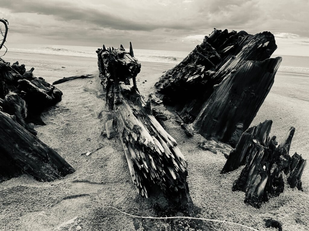
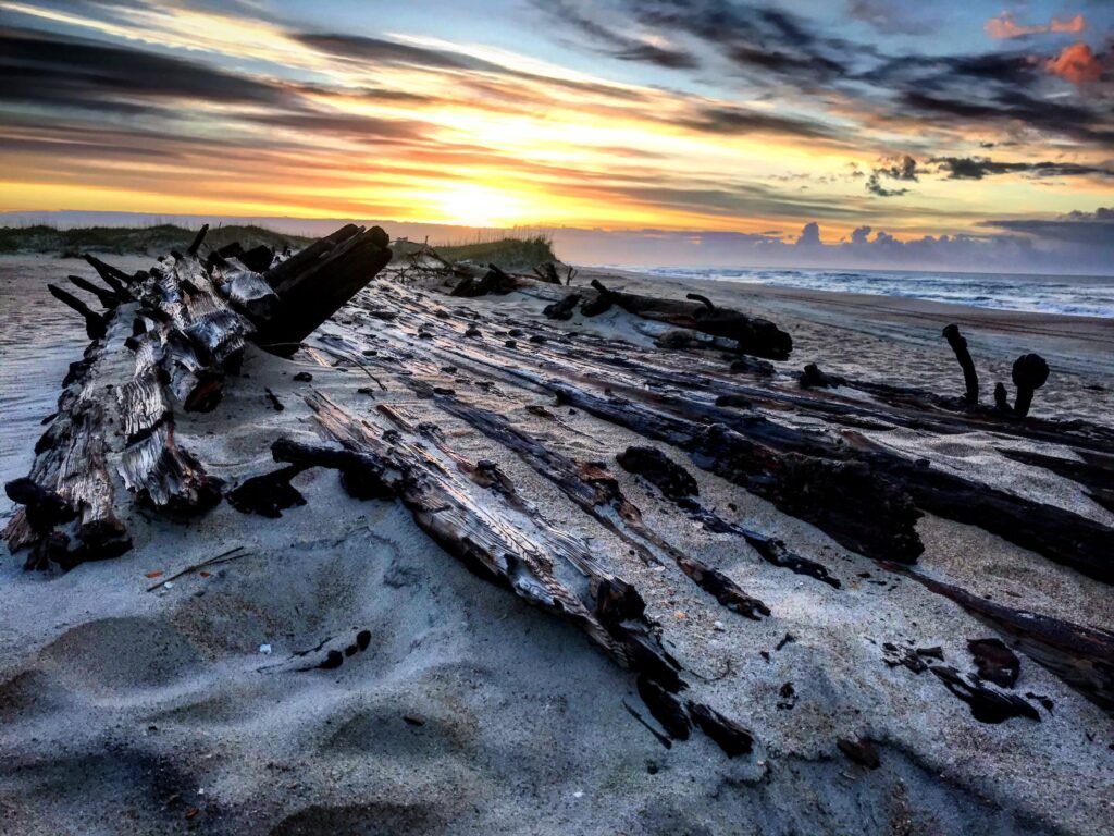
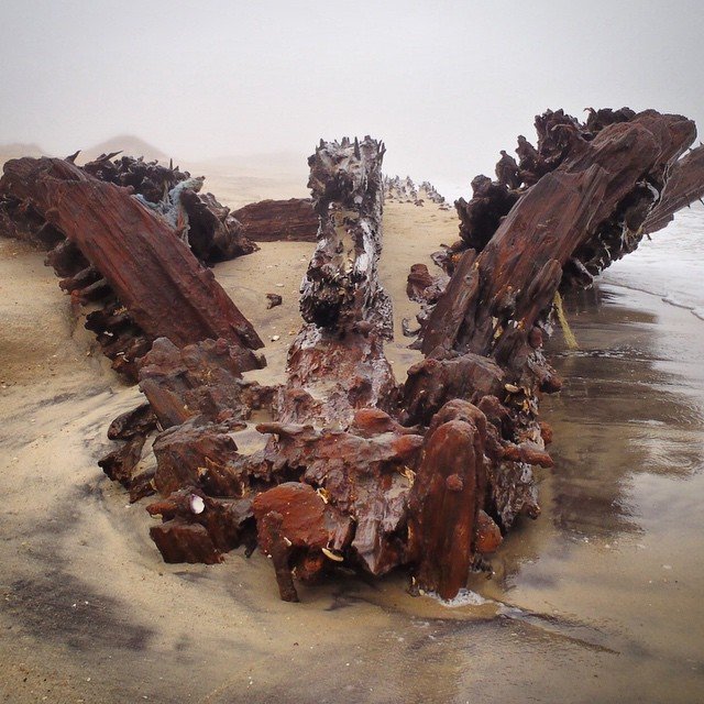
The rest keep their own schedules. The Laura A. Barnes, a four-masted schooner wrecked in 1921, rests at Coquina Beach near the Bodie Island Lighthouse — some seasons proud of the sand, some seasons swallowed by it. The G.A. Kohler, driven ashore by the 1933 hurricane and burned during WWII for her iron fittings, surfaces her charred ribs near Ramp 27 south of Salvo when the sand allows. She spent a full decade stranded upright on the beach as a local curiosity before the war effort claimed her.
The Lois Joyce, a trawler lost entering Oregon Inlet in 1981, shows at the inlet’s ocean-side mouth at low tide — 4WD country. Up north, the Triangle Wrecks sit about 200 yards off Kill Devil Hills for snorkelers on flat days, and the Winks Wreck off Luke Street in Kitty Hawk — an unidentified steamer, possibly from 1852 — demands calm water, high sun, and patience. After any big storm, walk the beach: unnamed wrecks surface somewhere on these islands every year.
The museum that holds the rest
For the other couple thousand stories — the U-boats sunk within sight of the beach in WWII, the pirate era, the lifesaving crews who rowed into hurricanes — the Graveyard of the Atlantic Museum at the end of the road in Hatteras Village is free, excellent, and open Tuesday through Saturday. It’s also the rainy-day ace on this end of the islands.
Why here: a short history of the graveyard
Four centuries of losses share one geography lesson: Diamond Shoals — shifting sandbars running miles out from Cape Hatteras — sit exactly where the cold Labrador Current collides with the warm Gulf Stream. Sailing ships rode those currents like highways, which forced them close to shoals that moved between one voyage and the next. Storms did the rest.
The islands answered with the U.S. Life-Saving Service: surfmen stationed every few miles who rowed open boats into hurricanes under an unofficial motto — you have to go out; you don’t have to come back. Their most famous hour came in 1918, when the Chicamacomico crew at Rodanthe pulled 42 British sailors from the burning tanker Mirlo through seas on fire with spilled fuel. The station still stands in Rodanthe as a museum.
The graveyard’s last busy season was 1942, when German U-boats sank ships within sight of these beaches so often that offshore waters earned the name Torpedo Junction — until the USS Roper caught U-85 on the surface near Bodie Island Light on April 14, 1942, and sank the first enemy submarine of the war in American waters. She lies off Coquina Beach today, too deep to see, close enough to matter.
Look, don’t launch: the safety part
These are real wrecks in real ocean. The Oriental sits in strong currents and draws fishing boats — anyone swimming near it needs a dive flag (that’s the law) and serious judgment. Snorkeling the Huron is genuinely doable but only on calm, clear days, ideally with a buddy and fins. Never climb on exposed wreckage — a century of rusted steel and splintered timber is exactly as sharp as it sounds — and mind bare feet around buried metal at the surf line. The wrecks survived this long; make sure you do too.
Frequently Asked Questions
Locally verified
Reviewed by the Beach4x4 team in Kill Devil Hills, NC
Last checked: August 2026
Sources: the official park, town and county pages for this topic. Always confirm hours, fees, and closures with the official source before you go.
Can you see shipwrecks from the beach on the Outer Banks?
Yes — eight are visible from shore, including the Oriental’s boiler off Pea Island (visible most days), the Pocahontas paddle-wheel shaft in Salvo, and the USS Huron off Nags Head, marked by buoys in summer.
Where is the Boiler Wreck?
About 100-150 yards off the beach directly across from the Pea Island trails — it’s the boiler of the Oriental, a Union transport grounded in 1862, and the easiest wreck to spot on the entire coast.
Can you snorkel to a shipwreck on the OBX?
The USS Huron off Bladen Street in Nags Head is the classic — about 200 yards out in 20 feet of water, buoy-marked in summer. Calm, clear days only, and bring a dive flag.
Why are there so many shipwrecks on the Outer Banks?
Diamond Shoals plus two colliding currents — ships riding the Gulf Stream or Labrador Current had to pass close to shifting shallows in storm-prone water. More than 2,000 didn’t make it, which is how the coast earned the name Graveyard of the Atlantic.
Related OBX Guides
Combine wreck-watching with a stop at the Bodie Island or Cape Hatteras lighthouses, explore more of the coast on our Outer Banks 4x4 Beach Access map, or save the Graveyard of the Atlantic Museum for a rainy day. Browse everything in our Things to Do in the Outer Banks guide. The storms that put so many of these ships on the beach — the 1899 hurricane, the two of 1933, the 1944 hurricane that sank the cutters Jackson and Bedloe — are on the Outer Banks hurricane history page.
The wreck hunting in the Netflix series? Kind of real — its fictional ships sail out of a coast that earned the name Graveyard of the Atlantic. The rundown of what the show borrowed matches the show’s places to the real record.