
Everything worth seeing in Nags Head is on the move. The tallest dune on the Atlantic coast is walking, and losing height while it goes. The first fishing pier ever built on this coast is gone; its replacement stands 250 feet longer and is made of concrete. Even the town’s name comes from a story nobody has ever been able to prove. This is the busiest stretch of the central beaches and it earns the traffic — but the reason to come is that none of it is standing still.
It is also the one town in the middle of the banks where you can put a truck on the sand. Roughly October through April, with a town permit, Nags Head opens its beach to driving — the off-season answer for anyone who missed the 4x4 beaches up north. Permit details are in this Nags Head beach driving permit guide. Everything below is on the map.
Save this map to your phone for offline use
Things to Do in Nags Head
Nobody here navigates by street address. It is mileposts — 11.5 for the old pier, 12 for the dune, 16.5 for Jennette’s — so keep the Nags Head milepost guide open while you read.
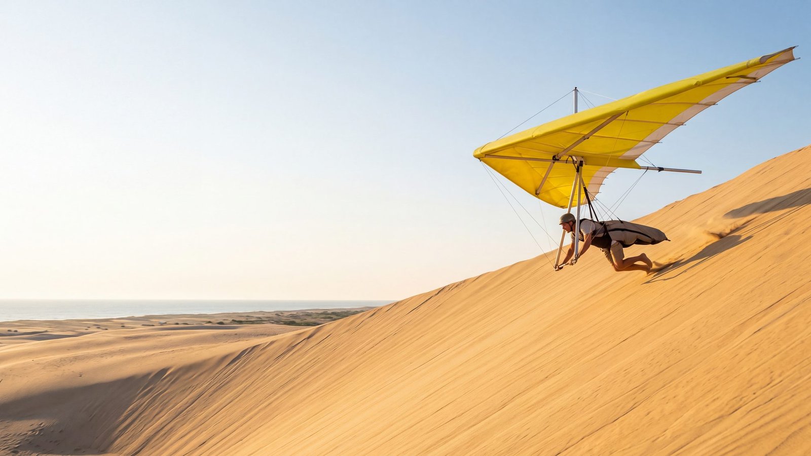
Jockey’s Ridge — 300 W Carolista Dr, MP 12. Everyone climbs it for the view, and almost nobody is told what they are standing on. In the 1970s the ridge broke 110 feet. At a park panel in September 2025 the superintendent put the tallest sections at barely 63. It is still the tallest living dune system on the Atlantic coast, and living is the whole story — living means it moves, and moving is why it is going: twelve million cubic yards of sand relocating a grain at a time, under your feet, while you take the photograph. Climb it at sunset once the sand has cooled, and take your shoes off at the top — six inches down it is cold even in August. The hang gliders overhead launched off the same slope. There is an accessible boardwalk out toward the dunes if the climb is not on.
Jennette’s Pier — 7223 S Virginia Dare Trail, MP 16.5. Warren Jennette Sr. started building here on 22 May 1939 and put up the first fishing pier the Outer Banks ever had: 750 feet of wood. Storms took pieces of it for sixty-four years and Isabel finished it in 2003. What stands now is the answer this coast keeps giving — the state rebuilt it in concrete, 1,000 feet, and opened it in 2011. You need no license to fish it; the pier carries a blanket one, so you can walk on with a rod and nothing else. There are aquarium tanks in the pier house for whoever came along and does not fish. Time a session against low water with the Nags Head tide times.
Nags Head Fishing Pier — 3335 S Virginia Dare Trail, MP 11.5. The wooden one, built in 1947 and still out there, which on this beach counts as an achievement. Tackle shop on site, and the Pier House Cafe sits out over the water.
The beach road cottages — roughly MP 12.5 to 13.5. Cedar-shake houses on stilts, built between 1915 and 1940 and never painted, so the salt has weathered every one of them silver. A Raleigh newspaper editor called them the Unpainted Aristocracy and the name stuck. They went on the National Register in 1977, when someone counted fifty-eight. They are private homes, so you look from the road or from the beach — which is the better angle anyway, because from down there you can see there is nothing between them and the water.
Nags Head Woods — entrance at 701 Ocean Acres Dr. A maritime forest behind the dune line: ponds, marked trails, and shade, run by the Nature Conservancy. It is the quiet opposite of everything else in this town. The entrance is technically over the Kill Devil Hills line even though the woods carry Nags Head’s name. Bug spray from May on.
Bodie Island Lighthouse — south of town toward Oregon Inlet, two wide black bands on white at the end of a marsh boardwalk. It is the third lighthouse on that spot: the first was abandoned on a bad foundation, the second was blown up in 1861 by retreating Confederate troops who did not want the Union using it, and this one has been lit since 1872. Climbing is seasonal and ticketed — check the National Park Service before you drive down. The inlet just past it is where the Wicked Tuna: Outer Banks fleet works out of.
Where the name comes from
You will be told that wreckers hung a lantern round an old horse’s neck and walked it along the dunes at night, so that ships would steer for what looked like a riding light and pile up on the bar. It is a very good story and there is no evidence for it. The name is on maps by 1738, and the same name turns up in England, the Channel Islands and the West Indies — which points at homesick settlers rather than murderers. Nobody has ever proved it either way, which is exactly why the story has outlived every attempt to kill it.
Where to Eat & Stay
Sam & Omie’s, 7228 S Virginia Dare Trail, opened in 1937 to feed charter crews before they went out and has not stopped. Small, loud, no view, and still the move — go early or wait. Lodging runs from the old beach-box cottages to the densest run of oceanfront motels on the beach road. Our full Outer Banks Restaurants guide covers the wider area.
Related OBX Guides
The Bodie Island Lighthouse sits in our lighthouse guide alongside the other four, and Jennette’s is in the pier fishing guide. Head north to Kill Devil Hills, where the dune the Wright brothers flew off had to be nailed down with grass before anyone could build a monument on it. Everything else is in our Things to Do in the Outer Banks guide.
Locally verified
Reviewed by the Beach4x4 team in Kill Devil Hills, NC
Last checked: September 2026
Sources: the official park, town and county pages for this topic. Always confirm hours, fees, and closures with the official source before you go.
Can you drive on the beach in Nags Head?
Yes, seasonally — the town allows beach driving roughly from October through April with a town-issued permit. In summer, the beach is for feet only.
What is Jockey’s Ridge State Park?
The tallest living sand dune system on the Atlantic coast, at 300 W Carolista Dr. It is also shrinking — over 110 feet in the 1970s, and barely 63 feet at its highest points by 2025. An accessible boardwalk runs toward the dunes, and the hang gliders overhead launch from them.
Do I need a fishing license at Jennette’s Pier?
No — the pier’s blanket license covers everyone fishing from it.
When can you climb the Bodie Island Lighthouse?
Climbing is seasonal and ticketed — check the National Park Service for current climbing status before you go.
Is Nags Head Woods actually in Nags Head?
Mostly — the preserve spans the town line, and the entrance at 701 Ocean Acres Dr is technically in Kill Devil Hills.
Brought the dog? The Salty Dog is a self-guided hunt we built to run Nags Head and Kill Devil Hills without a single leave-the-dog-in-the-car stop — the maritime forest, the big dune, a dog-legal stretch of beach, the dog park, and a puppy cup at the end. Half a day, morning start, $29 a team.