
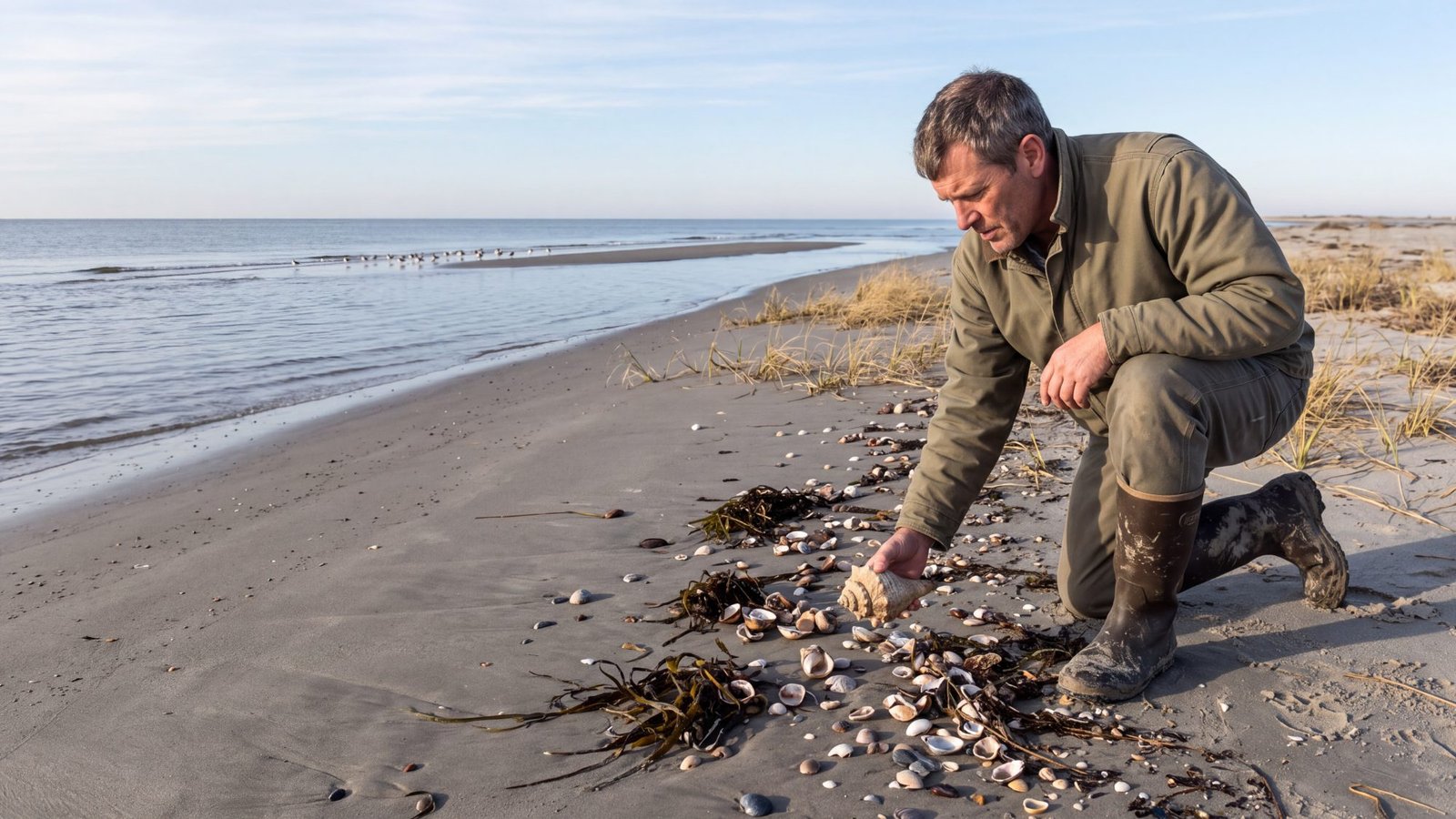
Ocracoke has been called one of the best shelling beaches in the country for nearly twenty years, and the reputation holds up. What has never been written down is the practical part: which of the six ramps puts you where, why the tide chart you are about to load is measuring the wrong water, and why more of this island is open to you in January than in July.
This page is the practical part. Everything on it comes from the National Park Service, the federal regulation that governs beach driving here, and NOAA — not from other shelling guides.
The short answer
Walk South Point. It is the southwest tip of the island at Ocracoke Inlet, it is reached year round by Ramp 72, and the Park Service kept it open on purpose when it closed comparable places. Why that matters is below.
Do not use the Ocracoke tide chart your phone hands you. That is the harbor gauge on the sound side, where the mean range is under ten inches. NOAA publishes a separate prediction point for Ocracoke Inlet, at South Point, and it runs well over twice that. Use that one instead.
Come in winter. Nothing on Ocracoke closes seasonally between December and February, the seasonal driving route at Ramp 68 is open then, and from November 16 to April 30 every route on the seashore is open twenty-four hours a day. In summer four of the six ramps do not open until seven in the morning.
And temper the Scotch bonnet expectation. The Park Service says of the state shell that it is “a somewhat uncommon find for beachcombers.” What you will actually pick up is better than that sounds.
The tide chart problem, and it is a real one
Every shelling guide tells you to go at low tide. On Ocracoke that instruction quietly breaks, and it breaks in a way that is easy to miss.
Search for an Ocracoke tide chart and what you will almost certainly be handed is station 8654769, “Ocracoke, Pamlico Sound.” The name is doing a lot of work. That gauge sits in the harbor, on the sound side of the village, and NOAA’s published datums give it a mean range of 0.81 feet — under ten inches. It is the wrong water.
The Atlantic beach is a different body of water, and NOAA publishes a prediction point for it that hardly anybody uses. Station TEC2793, “Ocracoke Inlet,” sits at South Point — the exact stretch this page sends you to. It is a subordinate station, which means NOAA gives it as an offset from a reference gauge rather than a meter in the water: +9 minutes at high water and +11 minutes at low against the Cape Hatteras Fishing Pier (8654400), with height ratios of 0.63 and 0.83. Run those out across a winter and the mean range at Ocracoke Inlet comes to about 1.9 feet — roughly 23 inches, against the harbor’s ten.
So if you type “Ocracoke tide” into a phone, stand on the ocean beach and wonder why the water is not doing what the numbers said, that is why. The island is about a mile wide there, and you are reading a gauge on the other side of it, in water the ocean tide barely reaches.
What to do instead
Ask for Ocracoke Inlet rather than Ocracoke, or look up station TEC2793 directly. Our sister site now runs both charts side by side on one page — the harbor one and the inlet one — so you can see the difference rather than take our word for it.
Either way the thing to plan around is the hour either side of low, and the mornings when that hour lands at first light are far rarer than people assume.
Sixteen and three-quarter miles, and no town in the way
Ocracoke is unusual among the Outer Banks islands in that the village does not front the ocean. It faces Silver Lake and Pamlico Sound. Rodanthe, Avon, Frisco and Hatteras all have village beaches carved out of the seashore, with their own seasonal driving rules written into federal regulation; Ocracoke has no such entry, because there is no Ocracoke village beach on the Atlantic side. Essentially the whole ocean shore of the island is National Seashore.
The Park Service maintains and publishes the mileage. Ocracoke holds 16.75 miles of seashore beach: 10.30 miles open to vehicles and 6.45 miles permanently vehicle-free. That last figure is the one worth sitting with — close to four miles in ten of this island is walk-only, all year, which is a far larger share than the ramp-by-ramp literature suggests. A beach nobody drives is a beach nobody has picked over from a truck window.
The six ramps — and yes, six
Most lists of Ocracoke ramps have five. There are six. Ramp 63 exists, it is named in the federal regulation that designates the driving routes here, and it appears in the Park Service’s own live beach-access status — but it has no page on the Park Service website, which is why it falls out of every list built by browsing nps.gov.
| Ramp | What it opens | Season | Worth knowing |
|---|---|---|---|
| 59 | The north end of the island, toward Hatteras Inlet | Year-round | Driving west of the ramp; the northeast end beyond it is walk-only. Parking for eighteen normal-sized vehicles plus two large spaces. |
| 63 | The upper middle of the island | Year-round | The ramp with no Park Service page. In the regulation and in the live access status, absent from every list. |
| 67 | The middle of the island | Year-round | Vehicle access and walk-on access, but no parking at all — so drive it or be dropped. |
| 68 | The beach in front of the Ocracoke Campground | Seasonal: October 15 to April 14 | Walk-on access year round. The driving route here exists only in the cold half of the year. |
| 70 | Either side of the ramp, by the airstrip | Year-round | A priority ramp, which means it is among the first the Park Service works to keep usable. |
| 72 | South Point Road, and the southern end of the island | Year-round | The farthest south ramp in the whole seashore, and a priority ramp. Horses are barred from it because of the traffic. |
There are also year-round soundside routes running west off NC 12 north of the pony pens — locally Prong Road, Barrow Pit Road and Scrag Cedar Road — and a route off Ramp 72 known as Shirley’s Lane. Those go to Pamlico Sound, not the ocean beach, so they are not shelling ground, but they are drivable and they are in the regulation.
South Point, and why the Park Service made an exception for it
South Point is the southwestern tip of Ocracoke, where the island runs out into Ocracoke Inlet. Officially it is a spit — that is the word in the regulation and in the management plan, not “hook.” You reach it by Ramp 72, which is also the name of the sand road, and the Park Service puts the walk from NC 12 at roughly one mile to the sound and almost two miles to the beach. It has no published figure for the drive down the beach beyond that, and neither will this page.
Here is the part that tells you something. When the Park Service wrote its off-road management plan, the general rule it adopted was that areas of high resource sensitivity and high visitor use would become vehicle-free year round or seasonal. Then it wrote the exception into the decision itself: “Except for Cape Point and South Point Ocracoke, areas of high resource sensitivity and high visitor use will generally be designated as VFAs year-round or as seasonal ORV routes.”
South Point is high-sensitivity habitat that was deliberately kept open all year. Two places on this entire seashore got that treatment, and this is one of them.
And the reason it is sensitive is worth knowing. From the same plan, on non-breeding piping plovers: “The fall migration counts were highest at South Point,” ahead of Oregon Inlet, Hatteras Inlet spit and Cape Point, with a single-day high of ninety-three birds in August. That is a plover figure, not a shorebird-wide one, and the further thought — that an inlet concentrates birds and shell drift for the same reason — is ours rather than the Park Service’s. It is why we send you here.
Which also means the thing to respect. Posted bird areas are closed to all public use and entry, and wintering and migrating plovers use South Point — so a winter visit is not a guarantee of an unposted beach, only of a much better chance.
Winter is the open season here, comprehensively
On most of the coast the off-season is a matter of fewer people. On Ocracoke it is written into the rules, three separate ways.
Seasonal driving routes are closed in summer, not winter. The Ramp 68 route in front of the campground runs October 15 to April 14. The Park Service states the general shape plainly: “There are seasonal closures along certain routes from April 15 to October 15.” The cold months are the open half.
South Point has a second season that opens even earlier. The regulation gives a separate September 15 to March 14 window for a route 0.6 mile south of Ramp 72 and for a route at the north end of the South Point spit, both running through to Pamlico Sound.
And from November 16 to April 30 there is no night-driving restriction at all. The regulation is explicit: in that window “all designated ORV routes are open 24 hours a day.” From May 1 the sea-turtle rules close the ocean routes at nine at night, and reopening is later than most people think. It is not six o’clock across the board: only Ocracoke’s two priority ramps, 70 and 72, open at 6:00 a.m. from May through July and 6:30 a.m. through August and September. Ramps 59, 63, 67 and 68 do not open until 7:00 a.m. all summer, and from October 1 to November 15 every ramp opens at 7:00. A dawn low tide in July is a walk-in, not a drive-in. In January you can be down there at any hour you like.
Nothing on Ocracoke closes seasonally between December and February. Bird and turtle closures here are resource closures rather than calendar ones — they go up as birds arrive and come down as nests hatch, and the Park Service publishes no fixed start and end dates for them. The seasonal routes are all open in that window. Temporary closures can still be posted at any time of year for safety or resource protection, so check the current status rather than trusting any page, this one included.
The permit, and the thing that catches people out
Driving any of those ramps needs a Cape Hatteras National Seashore off-road permit, and it is required year round — there is no winter exemption. One permit covers the whole seashore, Ocracoke included.
You cannot buy it over a counter on Ocracoke. The Park Service routes you to Recreation.gov: “You may obtain a permit at any time via the web by visiting www.recreation.gov. or call 1-877-444-6777 to be connected to a recreation.gov representative.” Then comes the part that catches people out — “You must print all three pages of the permit. The permit must be signed and the proof of permit must be properly displayed to be valid.” A phone in the windscreen is not a displayed permit. If you cannot print, the fallback is a self-certification card picked up outside a visitor center or from a local tackle shop, filled in against a permit you have already bought. It is not a point of sale.
There is no weekly permit. Two options only: a 10-day permit at $50 or an annual at $120, both read from the Park Service’s own permit page on September 3, 2026. Ten days, not seven — secondary sources get this wrong routinely. Prices move; check before you count on one.
The vehicle rules matter too, and they rule some things out entirely. The vehicle must be registered, licensed and insured, must have no more than two axles, and must carry a low-pressure tire gauge, a shovel, a jack and a jack support board. ATVs, UTVs and motorcycles are prohibited. The speed limit is 15 mph, and a driver must “slow to 5 mph when traveling within … 100 feet or less of pedestrians” — anywhere on the beach, any time of year. On a winter morning the pedestrian is usually somebody shelling.
And if you do not have a four-wheel-drive, Ocracoke is still the best island on this coast to arrive at on foot. Six ramps is the headline, but the number that matters for a walker is the other one: 6.45 of the island’s 16.75 seashore miles are permanently closed to vehicles. Nearly four miles in ten, never driven, all year. The beach is public from the waterline to the first line of stable natural vegetation, so all of it is walkable from a public access — a vehicle buys you distance down the sand, not permission to be on it. Ramp 72 and South Point are the exception worth renting for; the rest of the island rewards boots and an early start.
What you will actually pick up
Start with the honest part, because every other page on this subject leads with the shell you are least likely to find.
The Scotch bonnet is a long shot. It is the state shell of North Carolina, adopted in 1965, and it is genuinely associated with this stretch of coast. It is also, in the Park Service’s own words, “a somewhat uncommon find for beachcombers” — the living animal sits roughly fifty to a hundred and fifty feet offshore, so getting one onto the beach takes weather. Go hoping. Do not go expecting.
What the Park Service’s own mollusk guide for this coastline lists as common and notable: knobbed whelk, eastern oyster, bay scallop, Atlantic moon snail, Atlantic jackknife clam and coquina — the tiny fan-colored clams that reappear and burrow between waves at the water’s edge. The queen helmet is on that list too, but with the same caveat as the bonnet: it lives about thirty feet out, so it reaches the beach on a storm rather than on a Tuesday.
The North Carolina Shell Club, which is as close to a specialist authority as this subject has, names Ocracoke alongside Portsmouth Island and Core Banks as the state’s best bets for a bonnet — and of those three, Ocracoke is the only one you can reach with a car and sleep on. That is the whole argument for basing a trip here rather than day-tripping to somewhere better.
Portsmouth Island, five miles across the inlet
If you want the uninhabited version, it is close. Portsmouth Village sits across Ocracoke Inlet inside Cape Lookout National Seashore, and the Park Service puts the crossing at “5-mile trip from Ocracoke, North Carolina to Portsmouth Village takes approximately 20 minutes.”
Two details worth getting right. First, the boat from Ocracoke is an NPS-authorised operator, not the park concessioner — the concession runs from Harkers Island and Beaufort, at the other end. Second, it is booked by telephone: no online rates, no online booking. Ocracoke’s own tourism authority describes what is over there as “serious solitude, excellent surf fishing, and outstanding shelling.”
The catch for an off-season trip: the village buildings are staffed by volunteers only from mid-April to late October, and we could not verify whether the Ocracoke crossing runs through the winter at all. The Park Service says schedules vary and points at the operator. Call before you build a day around it.
The rules, with the actual numbers
Five gallons a person a day. Cape Hatteras publishes a hard limit, and it is buried where nobody looks — not on any beach or shelling page, but in the Superintendent’s Compendium, under the natural-products rule: “All uninhabited seashells – (One) 5-gallon bucket, not for commercial use.” Cape Lookout publishes the same figure for Portsmouth, and gives the reason: the limit protects “hermit crabs, which need seashells for shelter.” So both sides of Ocracoke Inlet run on one bucket a person a day.
Uninhabited means uninhabited. Cape Hatteras asks visitors not to take shells with animals in them; Cape Lookout extends it to squatters — “if a mollusk is still in its shell or another animal has made a shell its home, please leave those shells on the beach.”
A live whelk is a harvest, not a souvenir. Under North Carolina recreational rules, conchs and whelks carry no minimum size but a limit of ten per person per day, not to exceed twenty per vessel per day. No coastal recreational fishing license is needed for shellfish — that license covers finfish. Live bay scallops are a different matter again: that season is closed, and they are unlawful to possess. If it is alive, you are fishing, and the fishing rules apply.
Metal detecting and magnet fishing are prohibited at both parks. The Cape Hatteras compendium bans other metal detecting devices and applies the same rule to magnet fishing; Cape Lookout bans metal detectors outright to protect historic artifacts. Leave both at home.
Getting there, and why it has to be a night
Ocracoke is reached only by boat. From the north, the Hatteras–Ocracoke vehicle ferry is free through 2026 and first come, first served — NCDOT is explicit that it “does not require or accept reservations.” From the mainland, the Cedar Island and Swan Quarter crossings are tolled and take reservations up to ninety days out.
One change is coming that anyone planning a 2027 trip should know about. North Carolina Session Law 2026-41 requires the Ferry Division to begin collecting tolls on all ferry routes and set a fare schedule by January 1, 2027, which brings the free Hatteras–Ocracoke crossing into the toll system. NCDOT’s published timeline has recommended rates going to the Board of Transportation on October 8, 2026, adoption considered on November 5, and tolls in effect on January 1, 2027. As of September 2026 no rate had been set. Check the current position rather than assuming either the old price or a new one.
Put the pieces together and the overnight makes itself. The productive window is the hour either side of low tide, as early in the day as that low falls. The ferry does not run you across at four in the morning to catch it, and in summer you would not be allowed to drive the beach at that hour anyway. Either you are already on the island when the light comes up, or you are walking a beach somebody else walked first.
What we have not done
We have not walked these six ramps counting shells, and we are not going to tell you what was on the sand last week. What this page is: the access rules, the seasons, the permit and the tide reference, read off the primary documents and stated exactly.
Four things we deliberately left out because we could not source them. The beach-driving distance from Ramp 72 to South Point — the Park Service publishes a walking figure and no driving one, so neither do we. Fixed calendar dates for bird and turtle closures — they are resource closures, set biologically, and any page giving you firm dates for them is inventing them. Whether the Portsmouth ferry runs in winter. And the word “hook” for South Point — every official document says spit, so we say spit.
Asked and answered
Is Ocracoke good for shelling?
Yes, and for a structural reason rather than a sentimental one. The island holds 16.75 miles of National Seashore ocean beach with no town fronting it, 6.45 of those miles are permanently closed to vehicles, and its southwest tip sits on an inlet, which is where an ocean concentrates what it is carrying. Coastal Living put Ocracoke second in the country for shelling behind Sanibel back in 2007, and the North Carolina Shell Club still names it among the state’s best bets.
Where is the best shelling on Ocracoke Island?
South Point, the southwestern tip at Ocracoke Inlet, reached year round by Ramp 72. It is the one place on the island where inlet dynamics do the sorting for you — the Park Service’s own survey work found the seashore’s highest fall migration counts of non-breeding piping plovers there, ahead of Oregon Inlet, Hatteras Inlet spit and Cape Point. That an inlet concentrates birds and shell drift for the same reason is our inference, not theirs. The 6.45 miles of vehicle-free beach are the other place worth walking.
What is the best time of year to go shelling on Ocracoke?
Winter, and on Ocracoke that is written into the rules rather than just being quieter. Nothing closes seasonally between December and February; the seasonal driving route at Ramp 68 is open October 15 to April 14; a second window at South Point runs September 15 to March 14; and from November 16 to April 30 every route on the seashore is open 24 hours a day, with no night-driving restriction. From May 1 the sea-turtle rules close the ocean routes at 9 p.m., and reopening is staggered: Ocracoke’s priority ramps 70 and 72 open at 6 a.m. through July and 6:30 a.m. in August and September, while ramps 59, 63, 67 and 68 do not open until 7 a.m. all summer.
Why doesn’t the Ocracoke tide chart match what the beach is doing?
Because the chart you were given is almost certainly the harbor one — station 8654769, “Ocracoke, Pamlico Sound,” on the sound side of the village, with a published mean range of 0.81 feet, under ten inches. NOAA publishes a second prediction point for the ocean side that hardly anyone uses: station TEC2793, “Ocracoke Inlet,” at South Point, given as an offset from the Cape Hatteras Fishing Pier of +9 minutes at high water and +11 at low. Its mean range works out at about 1.9 feet, roughly 23 inches. Ask for Ocracoke Inlet, not Ocracoke.
How many ORV ramps are there on Ocracoke?
Six: 59, 63, 67, 68, 70 and 72. Most lists give five because Ramp 63 has no page on the Park Service website, but it is named in the federal regulation that designates the driving routes and it appears in the live beach-access status. Five of the six are year round; Ramp 68, in front of the Ocracoke Campground, has a driving route only from October 15 to April 14.
Do you need a permit to drive on the beach on Ocracoke, and where do you buy it?
Yes, a Cape Hatteras National Seashore off-road permit, required year round with no winter exemption. You cannot buy it on Ocracoke or anywhere else physical — the Park Service routes you to Recreation.gov, online or by phone, and requires that you print all three pages, sign the permit and display it properly — a phone in the windscreen does not count. There is no weekly option: it is a 10-day permit or an annual one. ATVs, UTVs and motorcycles are prohibited, and the vehicle must carry a tire gauge, shovel, jack and jack support board.
Can you find Scotch bonnets on Ocracoke?
Sometimes, but go hoping rather than expecting. The Scotch bonnet has been North Carolina’s state shell since 1965 and Ocracoke is one of the state’s better bets for one, alongside Portsmouth Island and Core Banks. The Park Service is blunt about the odds though: the living animal sits roughly fifty to a hundred and fifty feet offshore, and it calls the bonnet “a somewhat uncommon find for beachcombers.” Knobbed whelk, bay scallop, moon snail, coquina and jackknife clam are what you will actually fill a bag with.
How many shells can you take from Ocracoke?
One five-gallon bucket of uninhabited shells per person per day, non-commercial only. The figure is set in the Cape Hatteras National Seashore Superintendent’s Compendium rather than on any public shelling page, which is why almost nothing written about Ocracoke mentions it. Cape Lookout publishes the same limit for Portsmouth Island across the inlet. Shells with an animal in them, hermit crabs included, stay on the beach, and taking a live whelk is governed by the fishing rules instead: ten per person per day in North Carolina.
How do you get to Portsmouth Island from Ocracoke?
By boat across Ocracoke Inlet. The Park Service puts it at a five-mile trip taking about twenty minutes, run by an NPS-authorised operator — not the park concessioner, which runs from Harkers Island and Beaufort at the far end of Cape Lookout National Seashore. Booking is by telephone; there are no published online rates. The village buildings are staffed only from mid-April to late October, and whether the crossing runs through the winter is not something we could confirm, so call first.
Checked against the sources
The ramps, the routes and the seasons come from 36 CFR 7.58, the federal regulation that designates off-road routes at Cape Hatteras National Seashore, cross-checked against the Park Service’s individual ramp pages and its live beach-access status. Ramp 63 appears in the regulation and the access status but has no ramp page, which is why it is missing from most lists. Mileage figures are the Park Service’s own maintained summary, read September 3, 2026.
The South Point exception and the migration counts are quoted from the Record of Decision on the seashore’s off-road vehicle management plan. The permit rules and prices are from the Park Service’s own permit page and off-road FAQ, read September 3, 2026 — prices move, so check before you rely on one. The five-gallon shell limit is from the 2026 Superintendent’s Compendium for Cape Hatteras and the equivalent document for Cape Lookout.
The tide figures are NOAA published datums — mean range 0.81 ft at station 8654769, Ocracoke, Pamlico Sound, and 2.99 ft at station 8654400, Cape Hatteras Fishing Pier — plus NOAA’s published offsets for subordinate station TEC2793, Ocracoke Inlet (+9 and +11 minutes, ratios 0.63 and 0.83). The 1.9 ft figure for Ocracoke Inlet is our own average of NOAA’s predictions for that station across December to February. Correction: this page first said NOAA published only one prediction point for Ocracoke. It publishes two, and the Ocracoke Inlet one is the right one for the beach. Ferry facts are from NCDOT, including the Session Law 2026-41 tolling mandate, whose rates were not set when we read the page.
What we did not verify is set out in its own section above rather than hidden here. Rules, closures and prices change, and temporary resource closures can be posted at any time of year — check the Park Service’s current beach access status before you drive. This is general information, not driving or safety advice.